top banner
top banner

Roanoke Valley Hang Gliding Association

A brief history

The Roanoke Valley Hang Gliding Association was another pioneering group of hang glider pilots. By the early 80's they were very active in the Roanoke area, and had a number of sites very close by, including Montvale, Bonsack, 12 O'Clock Knob, Mason's Knob, Tinker Cliffs, and Roanoke Mountain. Tobacco Row was nearby, and RVHGA pilots also flew Big Walker and East River mountains. They were a very closely knit group, and made group decisions as to where to fly each weekend. Membership within the group was not automatic - you first had to fly and spend time with them, then be sponsored by a member, and finally, pass a member vote before you could become a member.

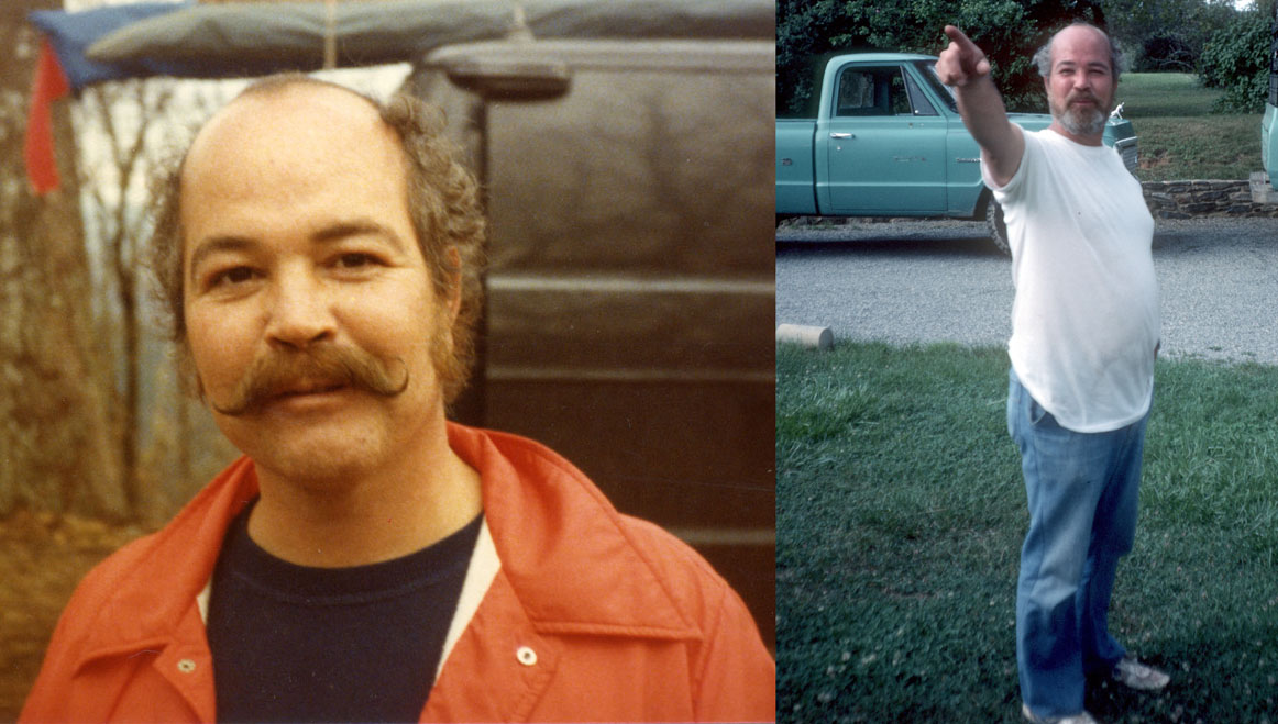
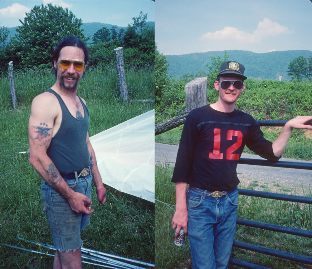
The RVHGA pilots had a defacto leader, William Wayne Richards, who was never called anything but "WW". He was their main instructor, glider repair guy, and a Region 9 USHGA Director.

W W Richards, defacto leader of the RVHGA and USHGA Region 9 Director
minutes

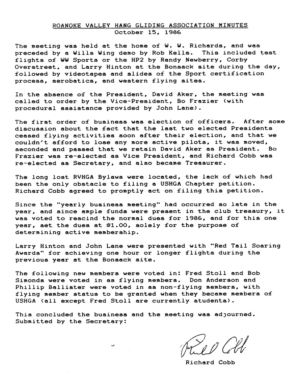
Like the original Skywackers, they don't seem to have had much of a focus on record keeping. Any records, if they exist, are likely in the attics of pilots who have long since retired from the sport. There was talk that the RVHGA had once been a USHGA Chapter, but by the mid 80's, when your author (Richard Cobb) became a member of the club, there was no current Chapter status with USHPA. At a meeting in 1986 the 1986 Meeting Minutes state that a long lost copy of the Club Bylaws had been located, which allowed for reapplication (and subsequent approval) of USHGA Chapter status. Your author was the Secretary at that time.

In 1988 WW Richards retired from hang gliding and moved to Florida. Within a year nearly all RVHGA flying activity ceased, with only a few active pilots remaining. A retirement party was held for WW combined with a club meeting to change the name to Southwest Virginia Hang Gliding Association (paragliders were not yet flying, at least in SW Virginia), and rewrite the Bylaws. These changes are discussed in the Club Merger portion of this history.

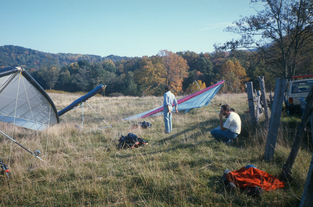
Unless/until someone produces more info on the earlier years, this history will have to be confined to photos and descriptions of some of the sites that were flown regularly.

RVHGA Site Locations

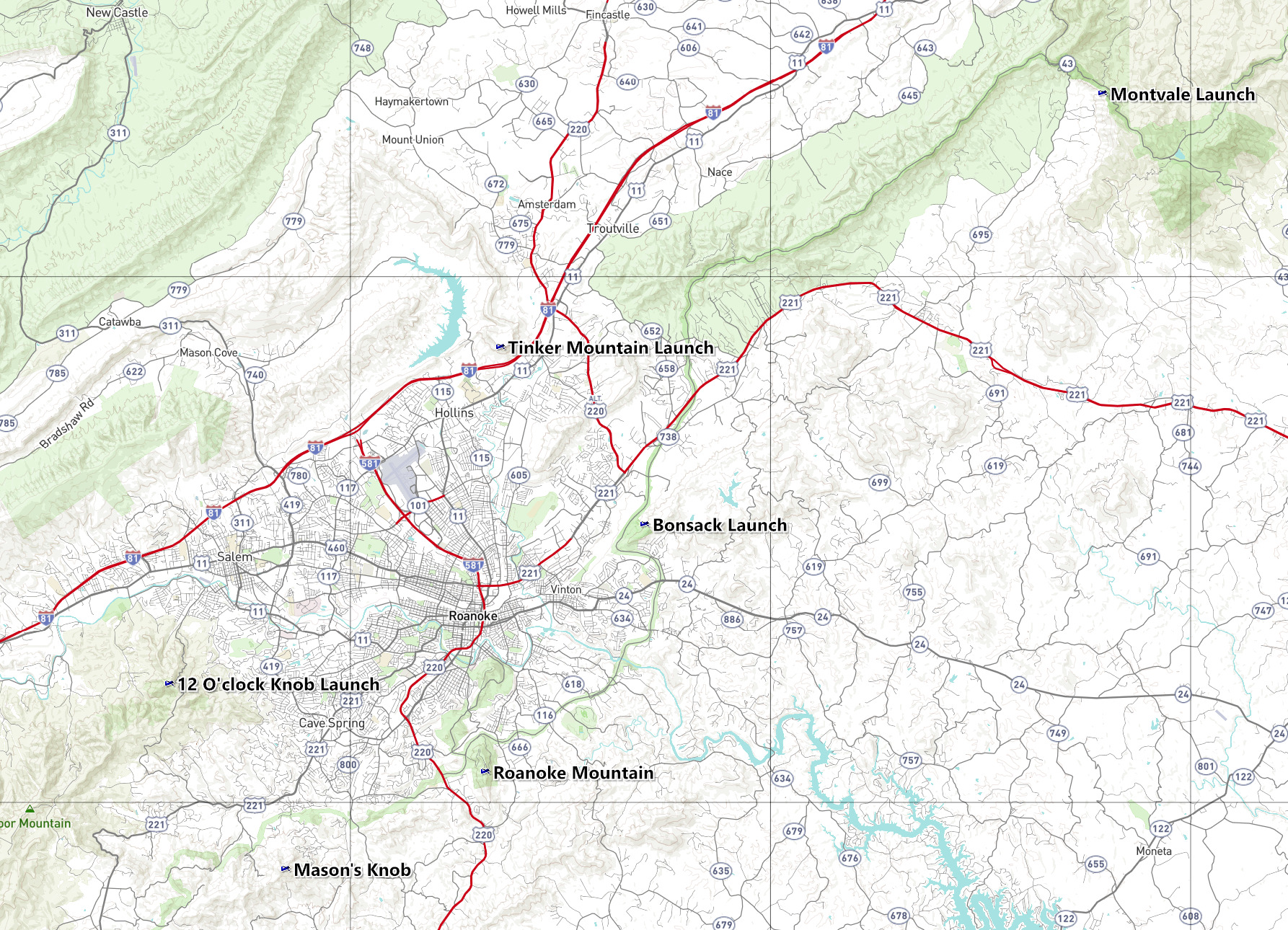
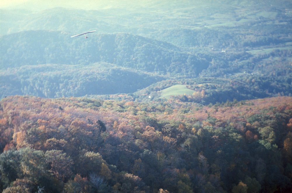
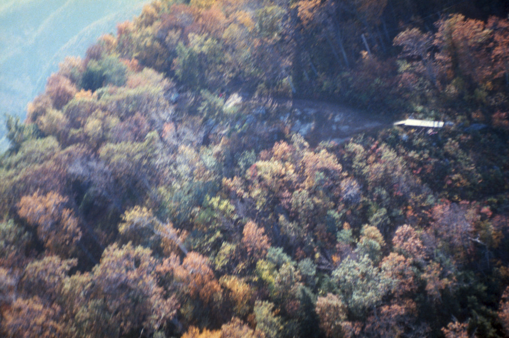
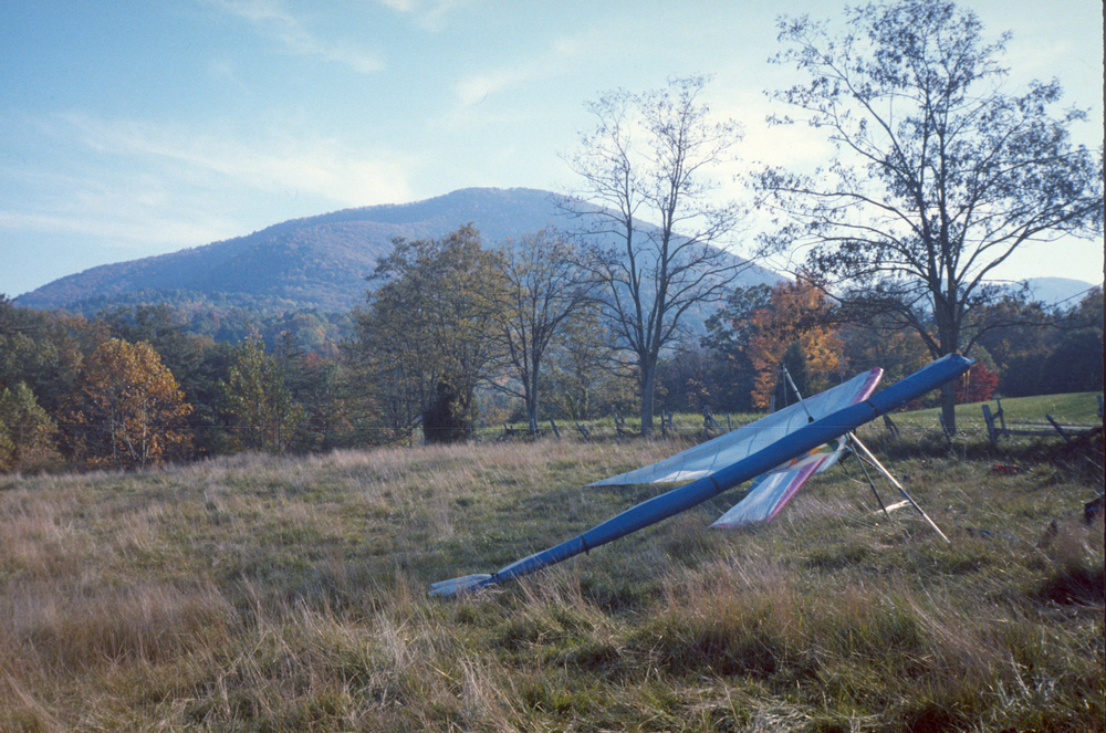
Locations of six of the sites flown by the RVHGA in the late 70's and early 80's (click to enlarge).

These are closed sites shown only for historical purposes

Approximate locations of the launches are in this RVHGA Site Coordinates GPX file which may be downloaded and displayed in Google Earth or other mapping application.

Important Notes:

  • These are closed sites and no attempt should be made to fly them without obtaining permission from launch and LZ owners
  • Some locations are approximate, and provided for historical reference only
  • Montvale

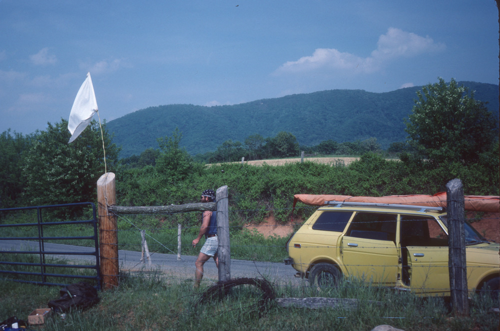
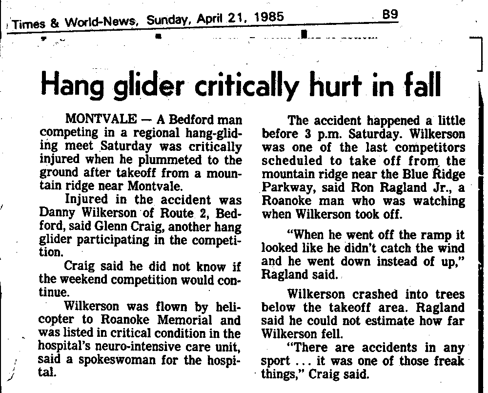
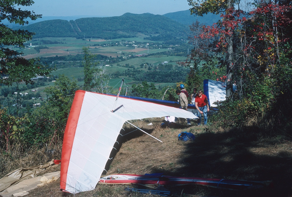
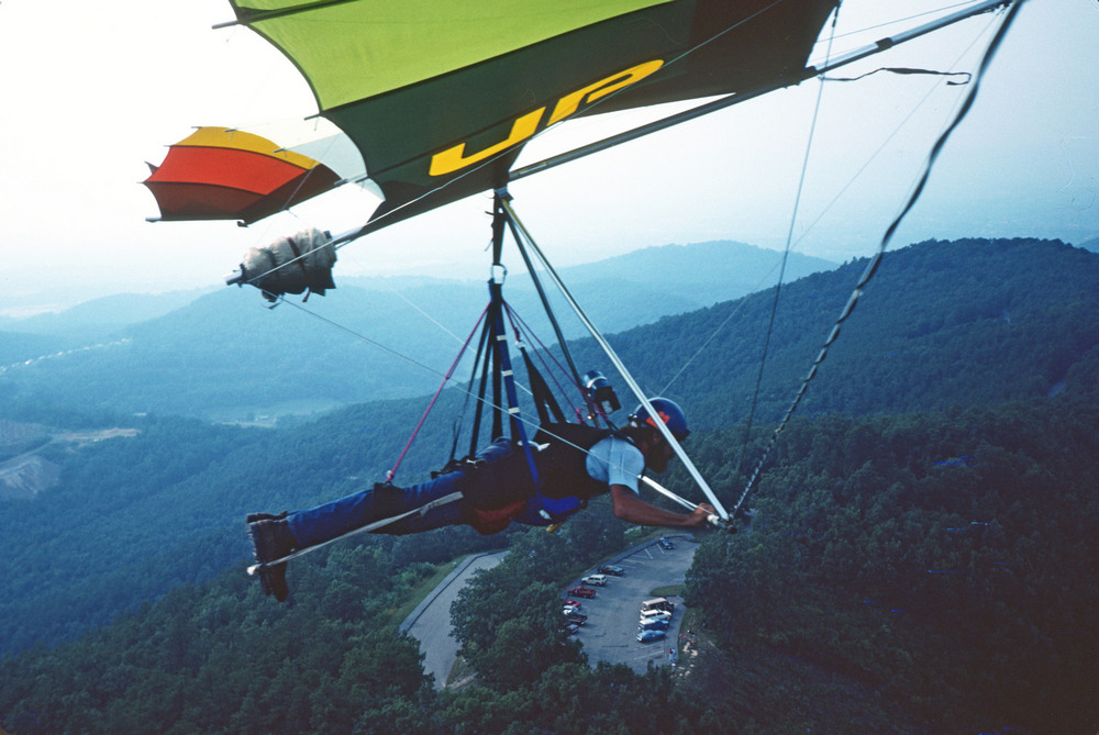
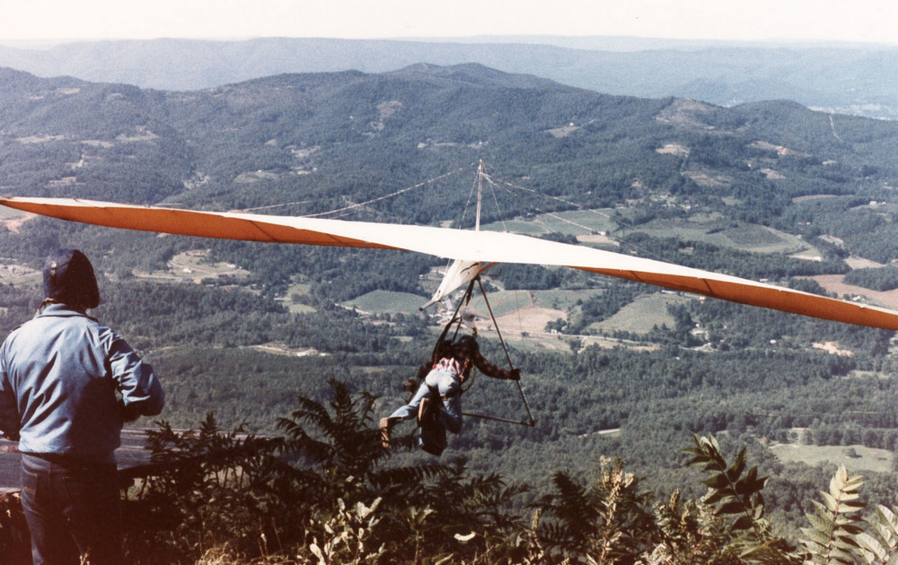
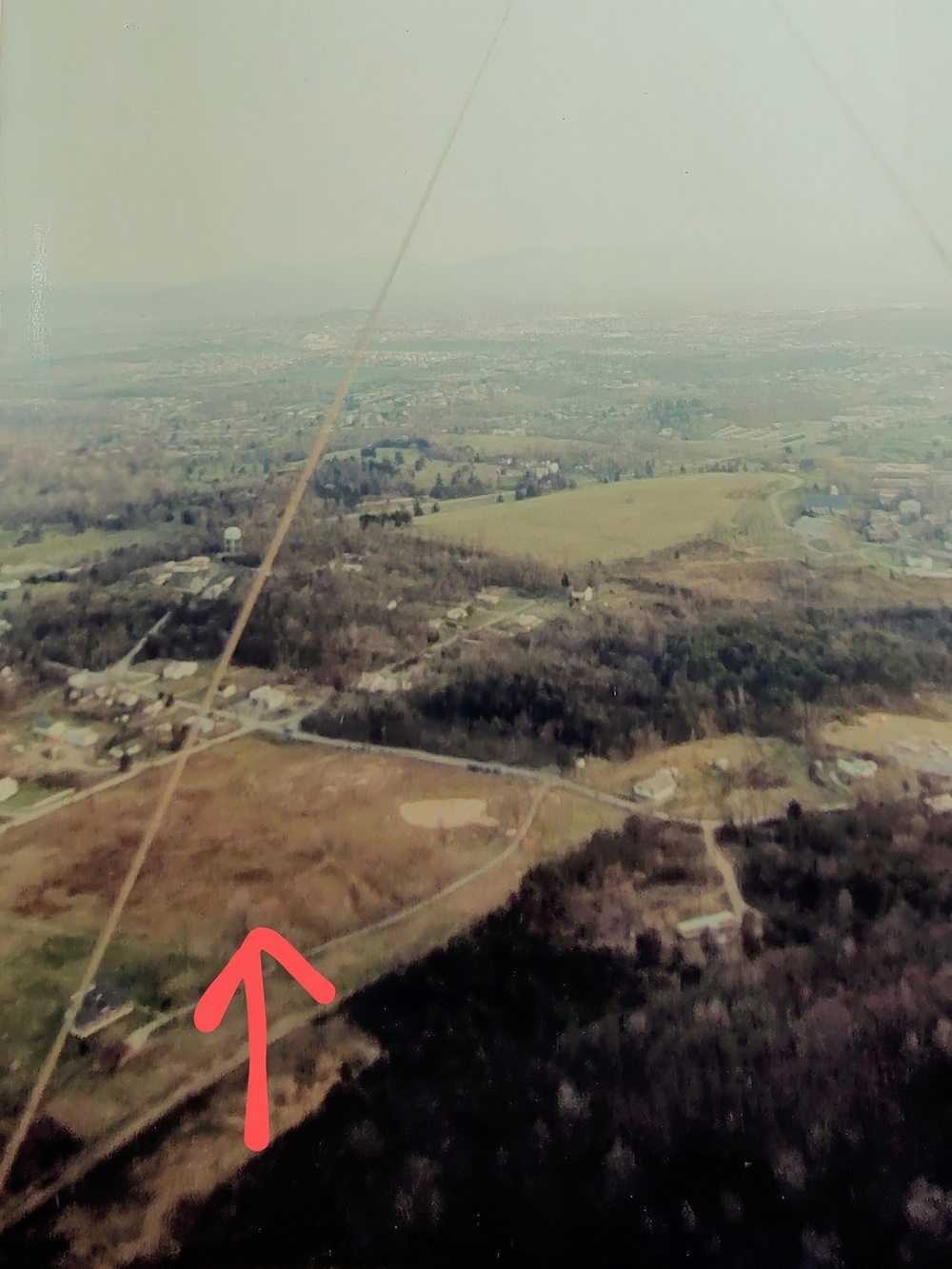
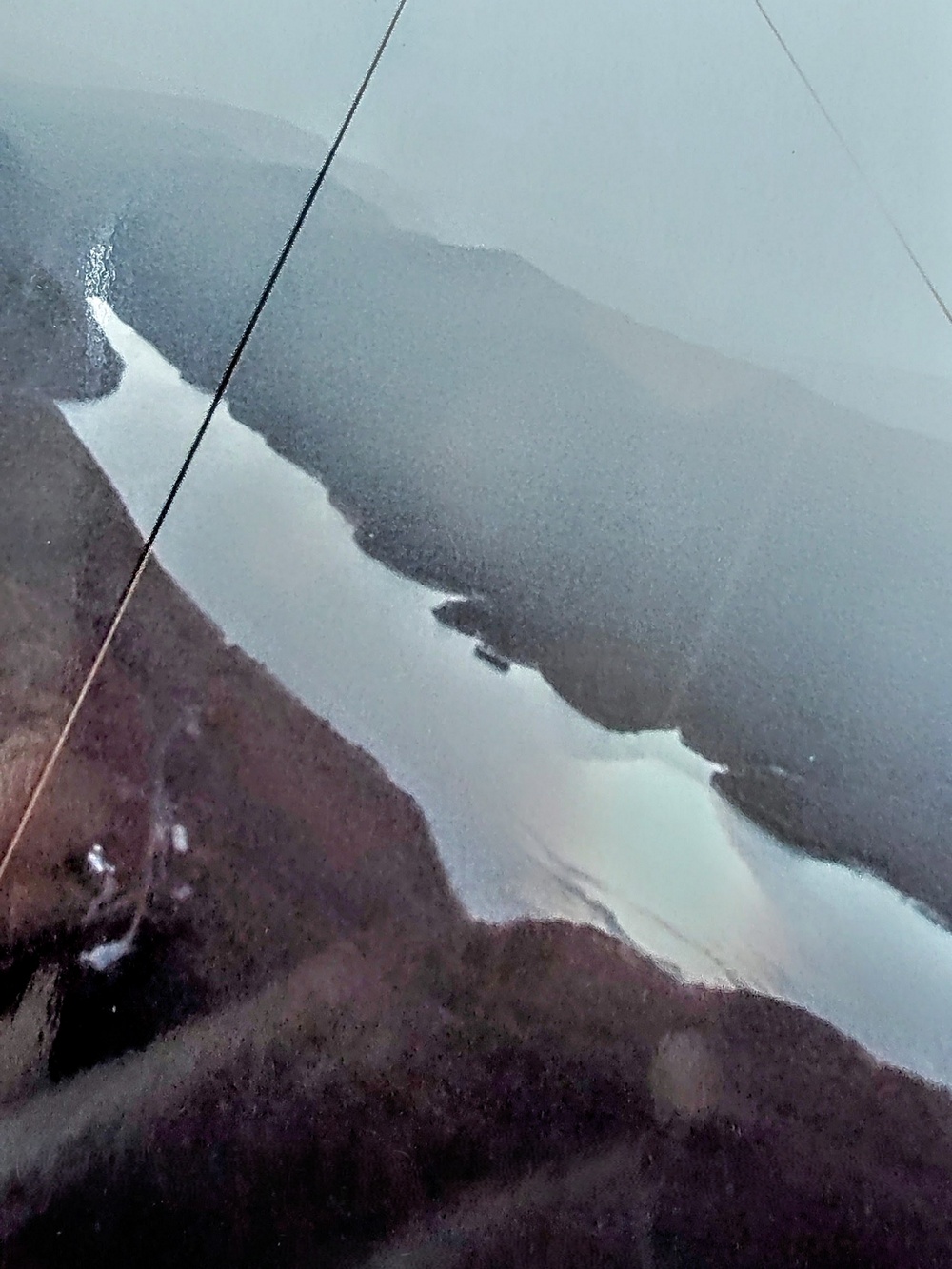
    The Montvale site was located at the head of Goose Creek Valley, near Montvale. It faced SW, which is a common wind direction for the area, and could handle some S cross fairly well, but a W component could provide sudden and unexpected turbulence from the Parkway ridge to the right.

    This is a closed site shown only for historical purposes

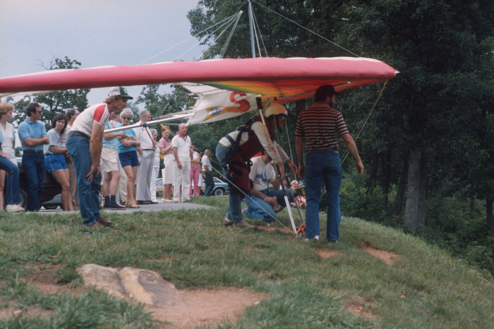
    The launch was very close to the Blue Ridge Parkway, but there was no access from the Parkway at the time. Instead access was via a terrifyingly steep road bull dozed up the end of the valley. Very few vehicles and/or drivers were capable of making it up the slope. One of the few vehicles that could make it was WW's Jeep Cherokee(?). It was so steep that your author watched the windshield washer fluid drain through the wiper lines onto the windshield(!). Even fewer people had the courage to drive down a slope that resembled a cliff.

    In later years (the 1990's?) an access route was found from the Parkway and the old road abandoned.

    Setup area
    Montvale setup area and launch ramp
    launch ramp
    Montvale - in line to launch
    launching
    Montvale - launching
    Mosquito
    Richard Cobb flying in front of launch in a UP Mosquito

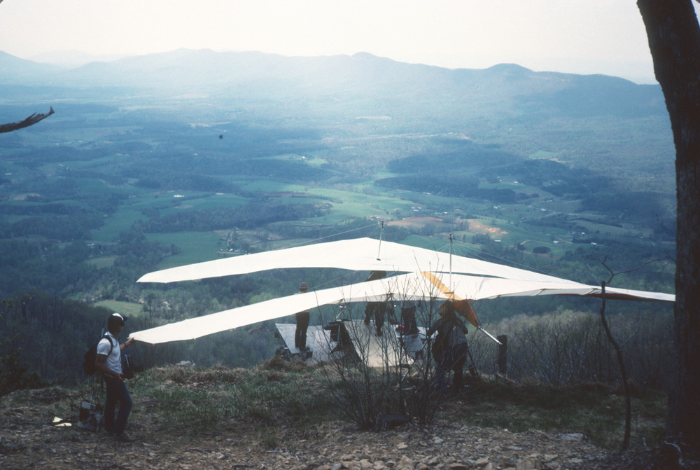
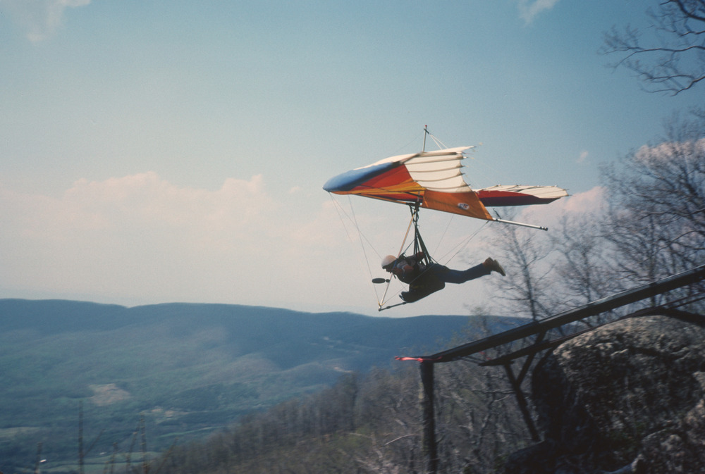
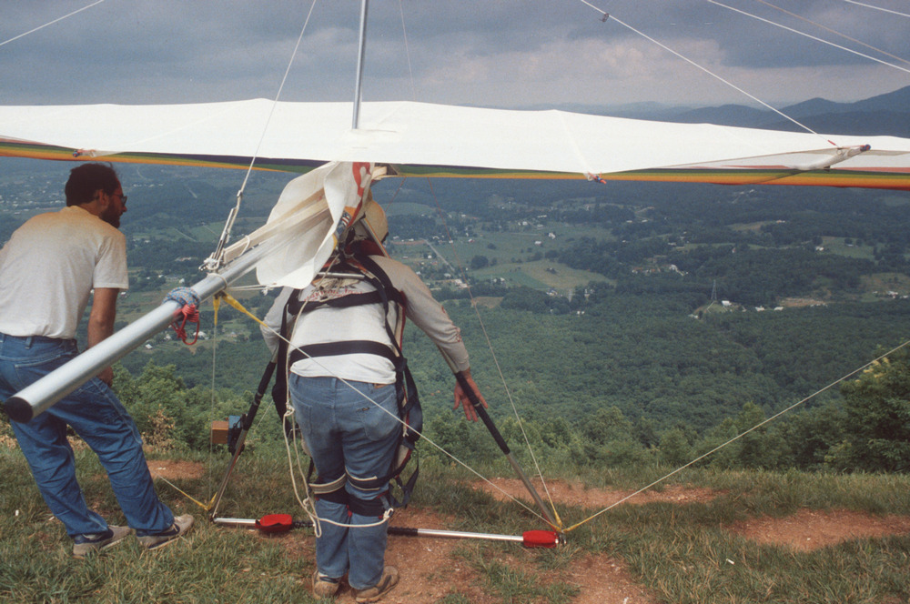
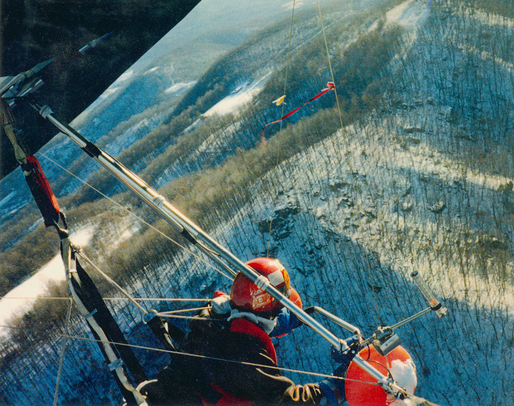
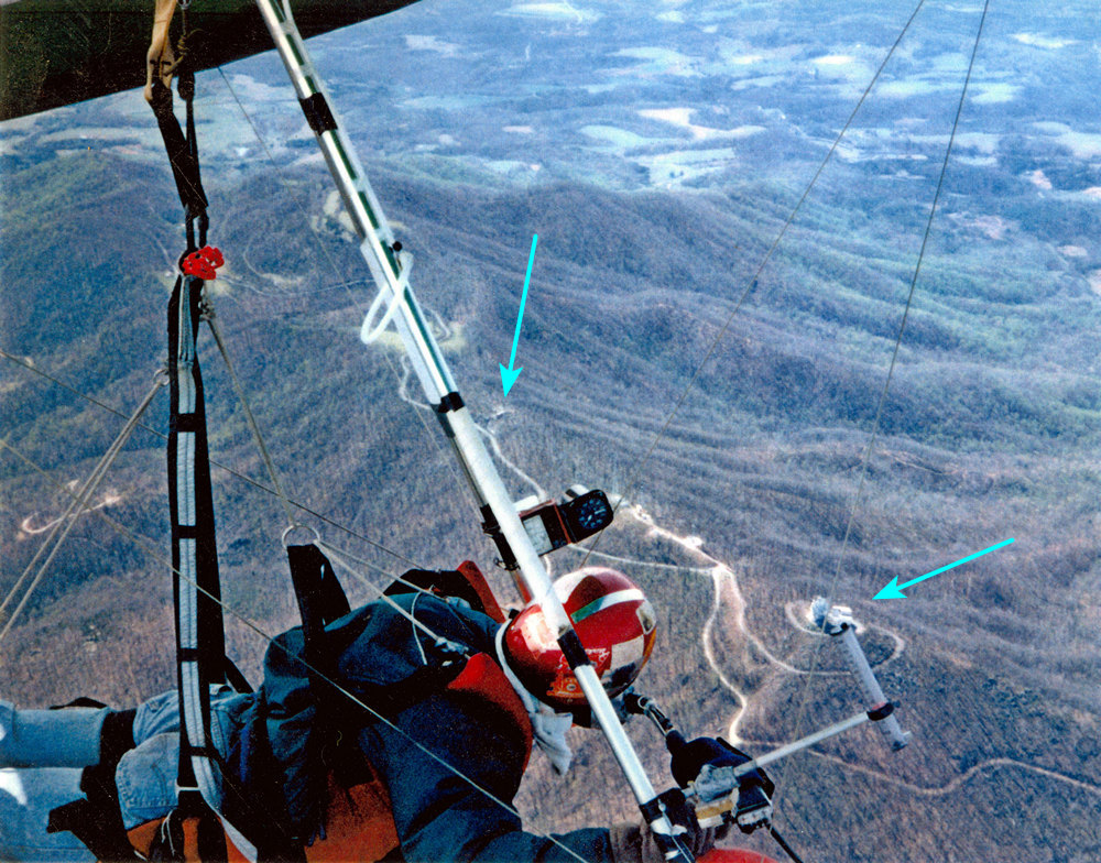
    If the wind had too much of a westerly component, the higher ridge on the West side of the valley could generate turbulence, often sudden and unexpected. Note the difference in the sail (and slack wires) on the UP Mosquito glider in the photos above and below. That sudden turbulence occurred on an otherwise normal flight.

    Sudden Turbulence - note the inverted sail compared to previous photo
    View of launch from the LZ. LZ is behind the photographer
    Mouse (Michael Venth) and Dale (Ashworth) were almost always seen together. They are in the Montvale LZ here. Dale died in a 2007 motorcyle accident, and is listed on the Final Flights page.
    accident
    This accident happened at an informal RVHGA Fly In/competition. He did recover.

    Bonsack

    The NW facing Bonsack site was located on the ridge to the East of the town of Bonsack. Unlike most sites, the launch was not located on the top of the ridge, but partway up, only a few hundred feet above the LZ. When the conditions were right, pilots could launch and climb above the ridge, otherwise, it was a short flight to the LZ.

    This is a closed site shown only for historical purposes

    Setup area
    Bonsack setup area
    on ramp
    On the Bonsack launch ramp
    launching
    Launching from the Bonsack ramp
    The ramp is above Bonsack, with US460 passing through the center of the valley.

    Roanoke Mountain

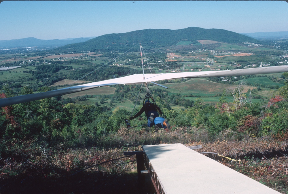
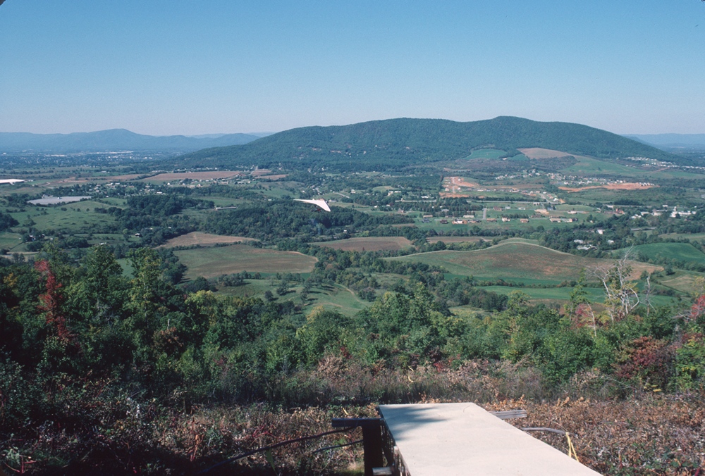
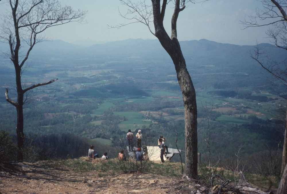
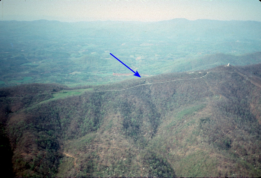
    The East facing launch on Roanoke Mountain was a popular site for many years. The launch was at the edge of the parking lot for a Roanoke Mountain Overlook on the Blue Ridge Parkway, which could become filled with spectators on a good flying day. The launch was a steep slope, with a 900 ft vertical 6:1 glide to the LZ, and no alternate closer LZ.

    This is not an active site, shown only for historical purposes

    Located in an approach path to the Roanoke Airport, flights were supposed to be limited to 500 ft. In general, East wind conditions are not great for altitude gains, so it normally wasn't a limitation. A decreasing number of hang glider pilots, lack of maintenance, and lack of a suitable paraglider LZ caused the site use to decline. The eventual opening of Eagle Rock, which also takes East winds, but without the flight level or LZ restrictions, became the end of Roanoke Mt as an active site.

    over launch
    Flying over the Roanoke Mt Overlook parking lot. The launch slope is at the bottom right.
    parking lot
    A pilot did well not to be concerned about spectators.
    launch
    The Roanoke Mt launch. The LZ is to the upper right of the pilot's shoulder, a fairly long glide that crosses a high voltage power line, and too far for paragliders to reach.
    LZ
    Roanoke Mt LZ - RVHGA pilots Corby Overstreet, Glen Craig, and Danny Wilkerson

    "A crowd of about 15-20 people gathered after John [Graham] and I set up. What a great set up area! John was wind dummy and got off with a step or two. Good launch then about 300 over on his second pass of the ridge. I was next and we got the glider to launch. I got a Piedmont airlines pilot, who was there for the view, to hold my side wire.. Eric held the other. But the wind was soooo smooth coming in the glider wanted to lift off. I haven't felt air like this since I was on the dunes at Kitty Hawk last year. I picked the glider up yelled clear and was up in a step. This was the most EXICTING mountain launch for me yet! What a trip!

    "I worked hard to get up past 300 over.. Then John (about 1500 over at that point)came on the radio and told me.. 'I know it is a little scary but work the backside where the sun is shining.' I crept over the back a bit and began to work some tight strong thermals. It worked! I Finally got to 1100 over. I Finally got to soar an EAST site!! We flew for an hour or so and landed. Good landings.. but the wind was coming from the South.. not particularly good there. But probably the strongest head wind I've landed in. Once I made my final tight turn into the wind.. the glider parked itself.. I pulled in for speed.. really didn't flare and settled down on two feet. What a great Flight!!!

    "This is a really strange site.. when you get 1,000 over you can see beautiful Blue Ridge mts all around.. then on the other side a big metropolis. Very strange. But very cool. And getting into the LZ is a head game.. you fly over many, many houses.. small neighborhoods and settle into a farmer's field right in the middle of it all. Really no bail outs. Big pucker factor here."

    Shane Moreland - recounting an April 2002 flight at Roanoke Mt

    Mason's Knob

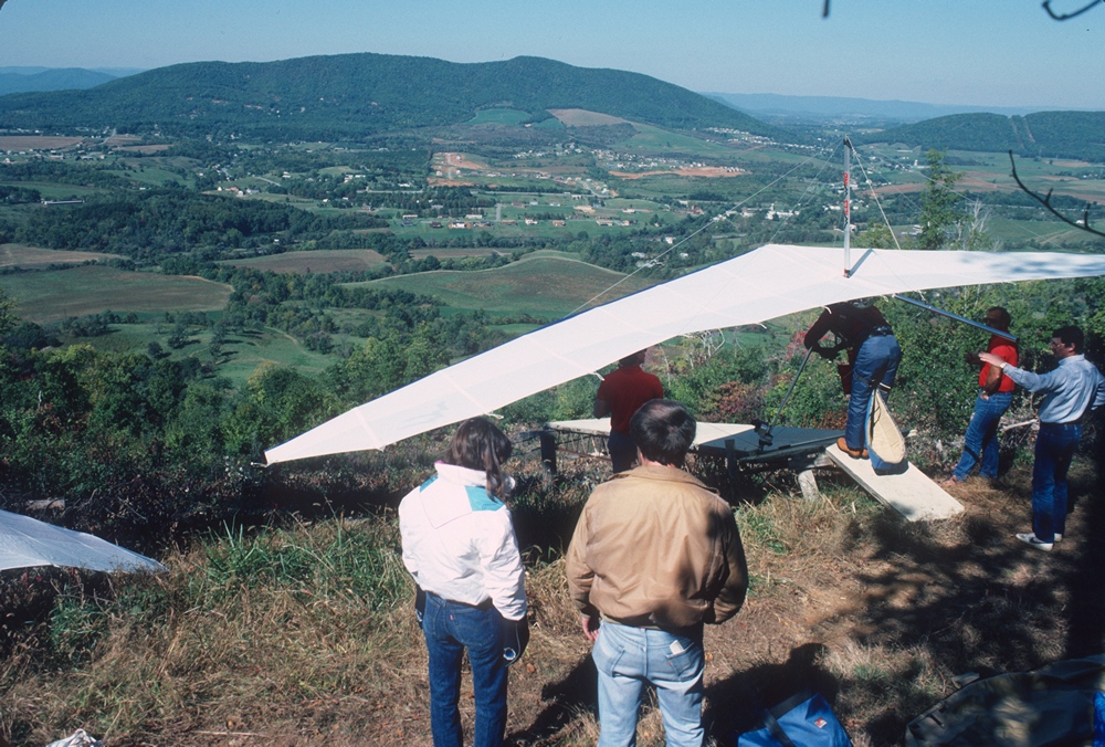
    Mason's Knob is a peak located SW of Roanoke with a NE facing launch ramp. At 1600 ft it is higher than other sites in the Roanoke area. This is another site lost to development, with the launch ramp area inside of a gated community.

    This is a closed site shown only for historical purposes

    WW launching
    WW Richards launching from Mason's Knob with a Suprone harness
    Randy launching
    Randy Newberry launching a Sensor glider from Mason's Knob
    glider
    A pilot scratching for lift over Fall colors on Mason's Knob
    air view
    An aerial view of the Mason's Knob launch ramp
    LZ1
    Mason's Knob as seen from the LZ
    LZ
    Glen Craig and John Graham in the Mason's Knob LZ

    12 O'clock Knob

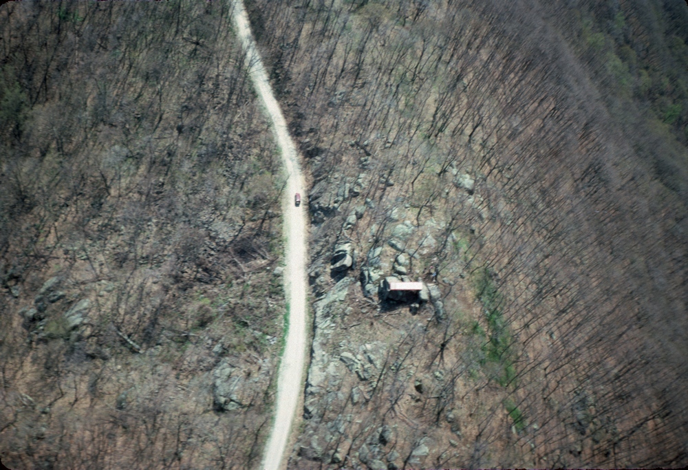
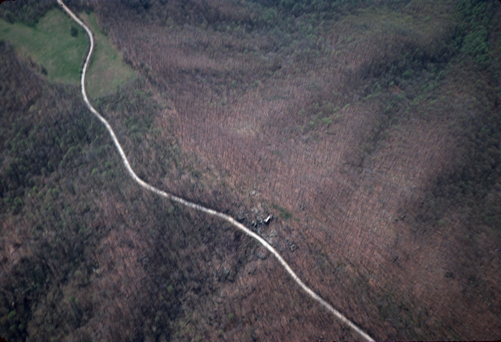
    This West facing launch was a ramp in a gas pipeline slot, near Salem, with a 1600 ft vertical descent. It was visible to the East of I-81. Development filled any viable LZ's. The Roanoke Control Tower was supposed to be notified before flying there.

    This is a closed site shown only for historical purposes

    12 O'clock
    Flying over 12 O'clock Knob. The launch is near the top of the gas pipeline cut.

    "Like many of our sites, the [12 O'clock Knob] landing field that was closest was small, sloped, and less than ideal. On some days you could ride the spine to the right and hop over where it diminished to land behind the store at Mill Lane and Riverside. That eventually was commercially developed. On a good thermalling day Timber Truss was a good option with a huge field that small planes occasionally landed in. It was the field used by RC planes also.

    "One of my best Roanoke Valley x-c flights was from 12 o'clock knob. I flew from there, out front of Mason's Knob, across Roanoke MTN, across Windy Gap MTN, and landed in a large field at Smith MTN Lake. If memory serves me, I believe it was 25 to 30 miles. This was before cell phones so I had to use a land line to call for a pick up."

    Corby Overstreet - former RVHGA Pilot

    Tinker Mountain

    This is a closed site shown only for historical purposes

    "We used to fly hang gliders off of [Tinker Cliffs] many years ago. It was a great site. A 5 mile per hour breeze down here in the valley could become a booming elevator launch due to the vertical cliffs amplifying the wind. [This caused] vertical wind and rotor at launch. The rotor would try to suck us right off it! So we would have people on the tail and wings and nose holding us on the rock until the pilot got even pressure on both wings. When we cleared the wires would actually twang when released and you usually would go almost straight up.

    "We have had a couple of people go over and down the cliffs on Tinker, one with and one without a glider and by some miracle, luck, or the grace of God neither sustained any serious injuries though it could have easily killed them.

    "We quit flying Tinker due to several reasons.

  • 1. We had lost access to any suitable landing fields on the mountain side of I-81. So we had started crossing I-81 and landing in a ballfield along Carvins Cove Road.
  • 2. We had a meeting with the head air traffic controller at the airport. He did not want us to cross the interstate (we were almost going under a approach path to the airport when we went to the ballfield).
  • 3. He also did not want us to get any higher than the towers on the mountain. This would have took a lot of the fun out of it and under certain conditions would have been hard not to do. However since then I believe some taller towers have been built up there so you could go a bit higher."
  • Jimmy Robertson - former RVHGA pilot, in a January 2002 listserve message

    Tinker Cliffs
    Flying in front of the launch on top of the cliffs. A glider is visible on top, near the boot of the harness. The road at bottom right is I-81
    Tinker ridge
    Corby Overstreet flying Tinker Ridge
    LZ
    This LZ was located across I-81 from the cliffs
    Carvins Cove
    Carvin's Cove, viewed from the west end of Tinker Mountain

    Tobacco Row

    For a great story about opening Tobacco Row to flying, see Bo Frazier's Tobacco Row History (pdf)

    This is a closed site shown only for historical purposes

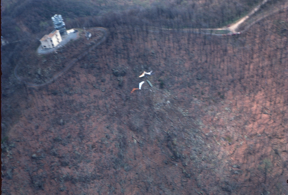
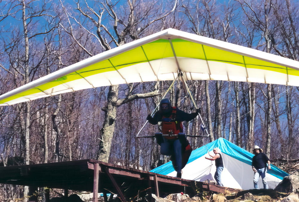
    Tobacco Row Mountain is an 1800 ft mountain located North of Lynchburg. It is unique in that it is located in a mostly flat area, East of the Blue Ridge range. It was opened in 1981 (see story above) and flown into the 1990's, with SE and NW launch ramps.

    The SE site was lost when housing took over all viable LZ's. The NW site had only a couple of viable LZ's amidst wooded land, and these were closed because of landowner relations. Somewhat tenuous permission was revoked when a visiting pilot ignored some site restrictions.

    John Lane
    John Lane flying over Tobacco Row
    locations
    John Lane over Tobacco Row - the SE launch is visible near the center, the NW launch not quite visible on the slope to the right.
    SE ramp
    The SE launch ramp was on a cliff overlooking the road to the top.
    SE ramp
    Another aerial view of the TR SE launch ramp
    overview
    Tobacco Row Mountain - the arrow points at the SE launch ramp, the NW ramp is on the other side of the mountain, just below the tower to the right.
    launching the SE side
    Launching the SE Ramp

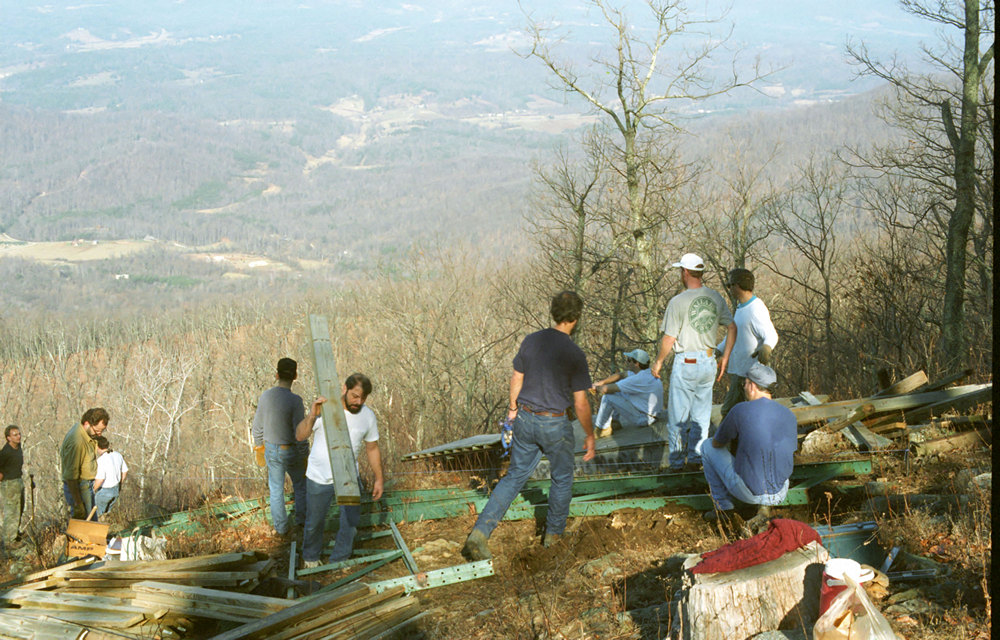
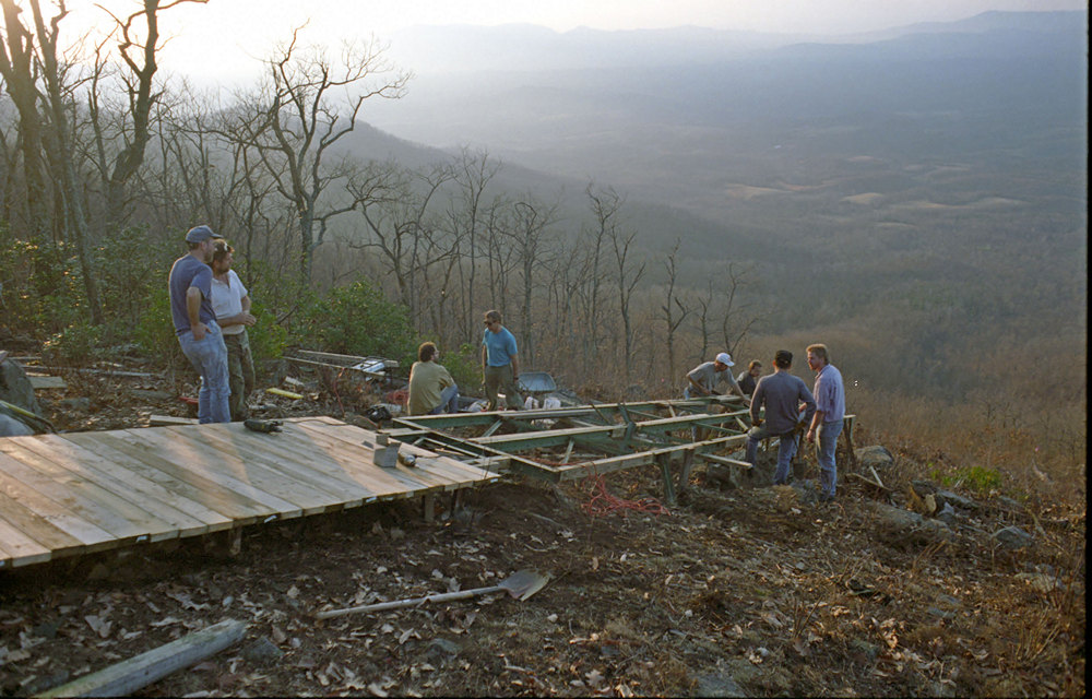
    In 1989 John Lane was the motivating person behind a complete rebuild of the ramp on the NW side. With a cast of thousands, this massive project was completed in a single day.

    ramp building
    Building a new NW launch ramp
    ramp building
    The new NW ramp provided for a long run.
    NW aerial
    The NW ramp with gliders set up
    Shane launch
    Shane Moreland launching the NW ramp at the beginning of a 54 mile XC flight.
    (updated February 24, 2024)

    Valid CSS!